| Dist. |
Location |
Elevation |
Marking |
Description |
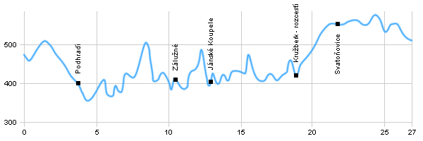
| 0,0 |
Vítkov |
474 m n.m. |
  |
 |
| 2,0 |
Horní Ves |
484 m n.m. |
  |
|
| 4,2 |
Podhradí |
411 m n.m. |
 |
Partially cyclo route |
| 10,2 |
Zálužné - bridge |
440 m n.m. |
 |
 Partially with green tourist route Partially with green tourist route |
| 11,3 |
U Mokřínek |
392 m n.m. |
 |
|
| 12,7 |
Jánské Koupele spa |
405 m n.m. |
 |
 |
| 18,8 |
Kružberk - crossroad |
430 m n.m. |
  |
 |
| 19,5 |
Kružberk BUS |
456 m n.m. |
  |
|
| 19,9 |
Kružberk |
490 m n.m. |
  |
 |
| 21,8 |
Svatoňovice |
551 m n.m. |
 |
|
| 24,7 |
Pod Haldama |
572 m n.m. |
 |
|
| 27,0 |
Budišov nad Budišovkou |
508 m n.m. |
|
 |
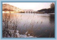
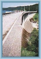
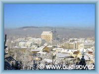
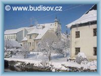
 | Vítkov – The church from the first part of 20th century is the dominant of the town. There is also a cemetery church. |  | Zálužné – bridge – A recreational settlement in the picturesque valley of Moravice river. There is a lot of evidence of slate mining where bats found their shelters. |  | Jánské Koupele – The settlement was a well visited spa between the beginning of 19th to the first part of 20th century. Heart, vessel, skin and rheumatic problems were treated there. Nowadays the spa building are pretty much ruined and the healing sources no longer used. |  | Kružberk –crossroad - The border of the National Park Moravice runs through this village with several churches and a stone cross. |  | Kružberk dam – Source of drinking water for the region of Ostrava. The size of the dam is 287ha. The flooded valley is 10 km long and the deepest place 31m. It was built between 1948-55. There are ruins of small castles Medlice and Šternek on both banks. |  | Budišov nad Budišovkou – Among the architectonical sights are the town hall from 1635, baroque church from 1745, town emblems on the town hall the school and post office, stone bridge with statue of Jan Nepomucký from 1725 and house number 230 by the bridge – the town museum. |
|


