| Dist. |
Location |
Elevation |
Marking |
Description |
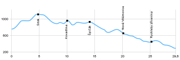
| 0,0 |
Ramzová |
758 m n.m. |
 |
 |
| 2,1 |
Klín |
983 m n.m. |
 |
|
| 4,8 |
Smrk |
1126 m n.m. |
 |
 |
| 10,0 |
Kovadlina |
976 m n.m. |
  |
 |
| 11,0 |
Sedlo Peklo |
842 m n.m. |
 |
|
| 14,0 |
Špičák |
947 m n.m. |
 |
 |
| 18,4 |
Hraničky |
709 m n.m. |
  |
 |
| 20,2 |
Nové Vilémovice |
660 m n.m. |
 |
|
| 23,6 |
Kaštanová alej |
471 m n.m. |
 |
|
| 25,3 |
Rychleby zřícenina |
448 m n.m. |
 |
 |
| 27,2 |
Sv. Antonín |
445 m n.m. |
   |
|
| 29,5 |
Javorník |
298 m n.m. |
|
|
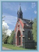
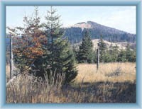
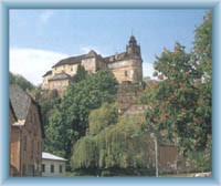
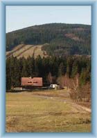
 | Ramzová – An important recreational area for winter and summer time. Cable cars run all year round Smrk- The highest mountain of Rychleby Mountains with a smaller peat-bog near the top with a few precious kinds of plants. |  | Javorník – Jánský hill with the imposing chateau is the dominant of the town. There are some well kept mansions on the square a beautiful town hall and a baroque church from 1718. |  | Kovadina- A hill on the border with Poland and an important crossroad with great views from the top. |  | Špičák – Špičák is the highest peak of Travenská Hillside. |  | Hraničky – A former mountain settlement by the border. Only one building has survived from what used to be quite a big village and it is called Zepletal Cottage. There are only ruins left of the formerly beautiful other cottages. Nowadays there is a border cross for pedestrians, cyclist, cross-country skiers, etc. |  | Ruin of Rychleby - A ruin of a gothic castle from 13th century which used to be a guard castle of a business trail from Nisa to Hradec Králové. It was deserted in 15th century. Today there are only remains of the walls and a tower turned into a viewpoint to the valley of Račí stream. |
|


