| Dist. |
Location |
Elevation |
Marking |
Description |
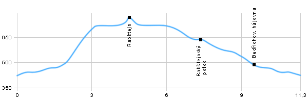
| 0,0 |
Bedřichov |
451 m n.m. |
  |
 crossorad with green tourist route crossorad with green tourist route |
| 1,6 |
Bedřichov, hájovna |
512 m n.m. |
 |
|
| 3,4 |
pod Rabštejnem crossroad |
731 m n.m. |
 |
crossorad with yellow and blue tourist route |
| 4,5 |
Ruins of castle Rabštejn |
790 m n.m. |
 |
 |
| 5,6 |
Rabštejn crossroad |
731 m n.m. |
   |
|
| 6,3 |
Pod Rabštejnem |
674 m n.m. |
  |
crossorad with blue tourist route |
| 7,4 |
Rabštejnský potok |
643 m n.m. |
 |
crossorad with yellow tourist route |
| 9,5 |
Bedřichov, hájovna |
512 m n.m. |
  |
|
| 11,3 |
Bedřichov |
451 m n.m. |
|
|
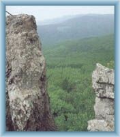
 | Bedřichov – A recreational area in the protected natural reserve Jeseníky. This area is mainly visited for its clear air and unspoiled nature. |  | The ruin of Rabštejn – This castle was the highest placed castle of historical Moravia. It was established in 13th century and deserted by 18th. It is possible to reach the ruin by ladders and there are great views of Haná and Hrubý Jeseník. The rocks are frequently visited by rock climbers. |
|


