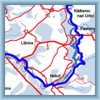
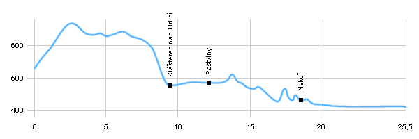
| Dist. |
Location |
Elevation |
Marking |
Description |
| 0,0 |
Zemská brána, bridge |
540 m n.m. |
 |
 cycle way no. 4073 cycle way no. 4073 |
| 1,0 |
Čihák, cottage |
590 m n.m. |
 |
cycle way no. 4073 |
| 4,0 |
České Petrovice |
640 m n.m. |
 |
cycle way no. 4073 |
| 6,5 |
Pod Bučinou |
630 m n.m. |
 |
cycle way no. 4073 |
| 9,5 |
Klášterec nad Orlicí |
480 m n.m. |
 |
 cycle way no. 4073, crossroad with cycle way n. 4076 cycle way no. 4073, crossroad with cycle way n. 4076 |
| 11,5 |
Kraví skok |
490 m n.m. |
 |
 cycle way no. 4073 cycle way no. 4073 |
| 12,0 |
Pastviny |
490 m n.m. |
 |
cycle way no. 4073 and cycle way no.4069 |
| 14,5 |
Studenský potok, crossroad |
480 m n.m. |
 |
cycle way no. 4073, cycle way no.4069 and crossroad with cycle way no.4076 |
| 15,5 |
Pastviny, dam, left side |
460 m n.m. |
 |
 cycle way no. 4073 cycle way no. 4073 |
| 18,0 |
Nekoř, bridge, right side |
440 m n.m. |
 |
cycle way no. 4073 and crossroad with cycle way no.4069 |
| 18,5 |
Nekoř, textile fabric |
430 m n.m. |
 |
cycle way no. 4073 |
| 21,5 |
Líšnice |
410 m n.m. |
 |
 cycle way no. 4073 cycle way no. 4073 |
| 25,5 |
Žamberk |
410 m n.m. |
 |
|
 | Nature Reserve |  | memorial trees |  | Iron Bridge |  | water dam Pastviny |  | church of St. Anna |
|
 Click to show full-size map


