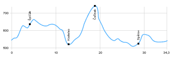
| Dist. |
Location |
Elevation |
Marking |
Description |
| 0,0 |
Třešť |
545 m n.m. |
 |
 cycle way no. 5090 cycle way no. 5090 |
| 4,8 |
U Hranečníku |
590 m n.m. |
 |
 |
| 7,1 |
Jezdovice |
540 m n.m. |
|
road 406 |
| 12,1 |
Kostelec |
519 m n.m. |
 |
 where green path enters to the forest, continue on asphalt road where green path enters to the forest, continue on asphalt road |
| 17,6 |
Chata pod Lípou |
770 m n.m. |
 |
we follow road constantly, even when brand turns into the woods |
| 19,6 |
Čeřínek |
610 m n.m. |
 |
 steep descent by brook Dolnohuťský potok steep descent by brook Dolnohuťský potok |
| 25,2 |
Dolní Cerekev |
528 m n.m. |
 |
 |
| 27,1 |
Spělov |
540 m n.m. |
 |
cycle way no. 5129 |
| 30,3 |
Jezdovice |
540 m n.m. |
 |
cycle ways no. 5129 and 16 |
| 34,3 |
Třešť |
545 m n.m. |
|
|
 | rising, it is possible to turn to Špičák - blue marked |  | descent in oak alley with a view to lake Jezdovický rybník |  | steep rising on comfortable road |  | round lake Klechtavec |  | it is possible to cut short on green path through medows |
|
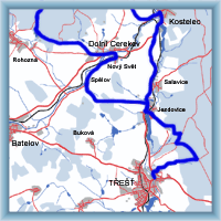
 Click to show full-size map


