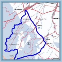
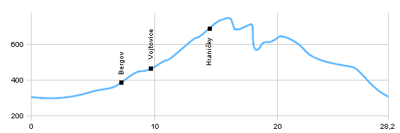
Length: 28,2 km
Dificulty: easy
Bikes: cross bike, mountain bike
Easy trail without difficult rise. Part of trail leads on asphalt road, but some parts on wooden paths. This trip takes us at the Poland boarder,and to beautifull valley Račí údolí with ruin Rychlebská zřícenina and Čertova kazatelna

|
|
 Click to show full-size map
|
| Dist. |
Location |
Elevation |
Marking |
Description |
| 0,0 |
Javorník |
295 m n.m. |
 |
 cycle way 6043 cycle way 6043 |
| 3,0 |
Uhelná |
308 m n.m. |
|
road number 60 |
| 5,7 |
Bergov |
380 m n.m. |
 |
 cycle way 6045 cycle way 6045 |
| 8,7 |
Vojtovice |
465 m n.m. |
 |
cycle way 6045 |
| 13,2 |
Hraničky |
690 m n.m. |
 |
 cycle way 6044 cycle way 6044 |
| 28,2 |
Javorník |
295 m n.m. |
|
|
 | road |  | it is possible to turn to Vlčice(castle, church of St. Bartoloměj, parks) |  | beutiful view to valley, Čertovy kazatelny |
|
 Click to show full-size map


